


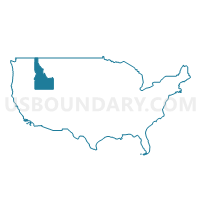
Canyon (South) & Owyhee Counties--Caldwell & Nampa (South & West) Cities PUMA, Idaho
About
Outline
+%26+Owyhee+Counties--Caldwell+%26+Nampa+(South+%26+West)+Cities+PUMA%2c+Idaho_A280.png)
Summary
| Unique Area Identifier | 192774 |
| Name | Canyon (South) & Owyhee Counties--Caldwell & Nampa (South & West) Cities PUMA |
| State | Idaho |
| Area (square miles) | 7,986.26 |
| Land Area (square miles) | 7,941.94 |
| Water Area (square miles) | 44.32 |
| % of Land Area | 99.45 |
| % of Water Area | 0.55 |
| Latitude of the Internal Point | 42.62917460 |
| Longtitude of the Internal Point | -116.19800660 |
Maps
+%26+Owyhee+Counties--Caldwell+%26+Nampa+(South+%26+West)+Cities+PUMA in Idaho.png)
Graphs
Select a template below for downloading or customizing gragh for Canyon (South) & Owyhee Counties--Caldwell & Nampa (South & West) Cities PUMA, Idaho
+%26+Owyhee+Counties--Caldwell+%26+Nampa+(South+%26+West)+Cities+PUMA%2c+Idaho_T0.png)
+%26+Owyhee+Counties--Caldwell+%26+Nampa+(South+%26+West)+Cities+PUMA%2c+Idaho_T1.png)
+%26+Owyhee+Counties--Caldwell+%26+Nampa+(South+%26+West)+Cities+PUMA%2c+Idaho_T2.png)
+%26+Owyhee+Counties--Caldwell+%26+Nampa+(South+%26+West)+Cities+PUMA%2c+Idaho_T3.png)
+%26+Owyhee+Counties--Caldwell+%26+Nampa+(South+%26+West)+Cities+PUMA%2c+Idaho_T4.png)
+%26+Owyhee+Counties--Caldwell+%26+Nampa+(South+%26+West)+Cities+PUMA%2c+Idaho_T5.png)
+%26+Owyhee+Counties--Caldwell+%26+Nampa+(South+%26+West)+Cities+PUMA%2c+Idaho_T6.png)
+%26+Owyhee+Counties--Caldwell+%26+Nampa+(South+%26+West)+Cities+PUMA%2c+Idaho_T7.png)
+%26+Owyhee+Counties--Caldwell+%26+Nampa+(South+%26+West)+Cities+PUMA%2c+Idaho.png)
Neighbors
Neighoring Public Use Microdata Area (by Name) Neighboring Public Use Microdata Area on the Map
- Ada (North), Payette, Canyon (North), Gem & Washington Counties--Eagle City PUMA, ID
- Ada County (South)--Boise (South) & Kuna Cities PUMA, ID
- Canyon (East) & Ada (West) Counties--Nampa (Central & East) & Meridian (West) Cities PUMA, ID
- Elmore, Jerome, Blaine, Minidoka, Gooding, Lincoln & Camas Counties PUMA, ID
- Klamath, Malheur, Lake & Harney Counties PUMA, OR
- Rural Nevada PUMA, NV
- Twin Falls & Cassia Counties--Twin Falls City PUMA, ID
Top 10 Neighboring County (by Population) Neighboring County on the Map
- Ada County, ID (392,365)
- Canyon County, ID (188,923)
- Twin Falls County, ID (77,230)
- Elko County, NV (48,818)
- Malheur County, OR (31,313)
- Elmore County, ID (27,038)
- Humboldt County, NV (16,528)
- Owyhee County, ID (11,526)
Top 10 Neighboring County Subdivision (by Population) Neighboring County Subdivision on the Map
- Nampa CCD, Canyon County, ID (119,851)
- Caldwell CCD, Canyon County, ID (35,456)
- Mountain Home CCD, Elmore County, ID (24,241)
- Orchard CCD, Ada County, ID (19,106)
- Kuna CCD, Ada County, ID (18,941)
- Middleton CCD, Canyon County, ID (14,813)
- Parma CCD, Canyon County, ID (4,846)
- Wilder CCD, Canyon County, ID (4,735)
- Homedale CCD, Owyhee County, ID (4,334)
- Huston CCD, Canyon County, ID (3,807)
Top 10 Neighboring Place (by Population) Neighboring Place on the Map
- Nampa city, ID (81,557)
- Caldwell city, ID (46,237)
- Homedale city, ID (2,633)
- Marsing city, ID (1,031)
- Owyhee CDP, NV (953)
- Greenleaf city, ID (846)
- Notus city, ID (531)
- Melba city, ID (513)
- Grand View city, ID (452)
- Murphy CDP, ID (97)
Top 10 Neighboring Unified School District (by Population) Neighboring Unified School District on the Map
- Boise City Independent School District 1, ID (184,995)
- Nampa School District 131, ID (83,622)
- Elko County School District, NV (48,818)
- Vallivue School District 139, ID (38,269)
- Caldwell School District 132, ID (34,538)
- Kuna Joint School District 3, ID (25,863)
- Mountain Home School District 193, ID (24,115)
- Humboldt County School District, NV (16,528)
- Middleton School District 134, ID (15,084)
- Buhl Joint School District 412, ID (8,666)
Top 10 Neighboring State Legislative District Lower Chamber (by Population) Neighboring State Legislative District Lower Chamber on the Map
- State House District 21, ID (71,377)
- State House District 13, ID (58,725)
- State House District 60, OR (55,458)
- Assembly District 33, NV (51,407)
- State House District 11, ID (51,062)
- State House District 10, ID (48,958)
- State House District 23, ID (45,710)
- State House District 12, ID (45,474)
- State House District 22, ID (34,066)
Top 10 Neighboring State Legislative District Upper Chamber (by Population) Neighboring State Legislative District Upper Chamber on the Map
- State Senate District 30, OR (115,913)
- Rural Nevada Senatorial District, NV (97,335)
- State Senate District 21, ID (71,377)
- State Senate District 13, ID (58,725)
- State Senate District 11, ID (51,062)
- State Senate District 10, ID (48,958)
- State Senate District 23, ID (45,710)
- State Senate District 12, ID (45,474)
- State Senate District 22, ID (34,066)
Top 10 Neighboring 111th Congressional District (by Population) Neighboring 111th Congressional District on the Map
- Congressional District 1, ID (841,930)
- Congressional District 2, NV (836,562)
- Congressional District 2, OR (769,987)
- Congressional District 2, ID (725,652)
Top 10 Neighboring Census Tract (by Population) Neighboring Census Tract on the Map
- Census Tract 104.01, Ada County, ID (18,941)
- Census Tract 211, Canyon County, ID (15,829)
- Census Tract 209.02, Canyon County, ID (14,190)
- Census Tract 209.01, Canyon County, ID (12,861)
- Census Tract 210.01, Canyon County, ID (12,097)
- Census Tract 217, Canyon County, ID (10,356)
- Census Tract 210.02, Canyon County, ID (9,199)
- Census Tract 219.03, Canyon County, ID (8,928)
- Census Tract 204.01, Canyon County, ID (8,612)
- Census Tract 9604, Elmore County, ID (8,150)
Top 10 Neighboring 5-Digit ZIP Code Tabulation Area (by Population) Neighboring 5-Digit ZIP Code Tabulation Area on the Map
- 83686, ID (46,224)
- 83605, ID (39,649)
- 83687, ID (29,697)
- 83651, ID (28,611)
- 83634, ID (24,494)
- 83607, ID (21,732)
- 83647, ID (20,789)
- 83316, ID (9,626)
- 83660, ID (5,890)
- 83676, ID (4,347)